Description
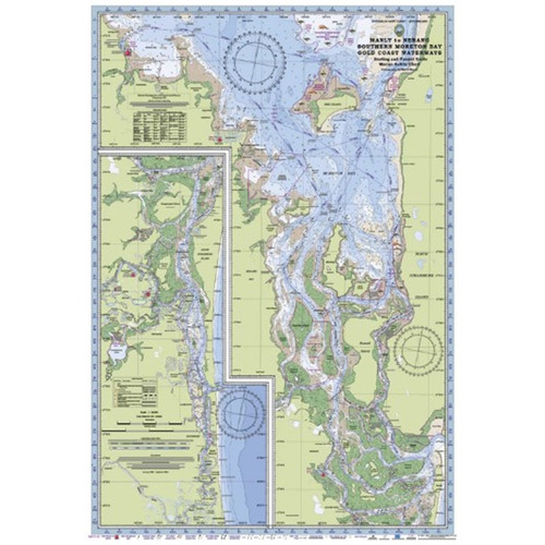
Chart of Moreton Bay Laminated
The Laminated Chart of Moreton Bay is a comprehensive and visually stunning resource for anyone interested in exploring and understanding the intricate details of this iconic Australian bay. This laminated chart is meticulously designed to showcase the bay's topography and important landmarks. With vibrant colors and clear labeling, this chart provides a user-friendly reference for sailors, divers, fishermen, and nature enthusiasts alike. The laminated finish ensures durability and protection against water damage, making it an ideal companion for your adventures on Moreton Bay.
- Water contours are shades of blue becoming progressively darker as depth increases
- Land contours become progressively darker as height increases
- Natural features, mangroves, sand types, mud, salt pans and others features are visually realistically depicted
- Grid reference system, latitude and longitude simplifies identifying positions for boating, fishing and rescue services
- Marine Emergency Search and Rescue contact details for Police and Volunteer Rescue Services are easily located on the chart
- Navigation marks and symbols are clearly indicated on the chart without the need for supplementary handbook
- Known information such as names, heights, depths, seabed, GPS marks, obstructions and navigational tracks included
- No fishing Zones, officially declared speed zones clearly indicated
- Lesser known information such as local knowledge of fishing and diving locations, local common names and information from latest satellite images are included at time of publication


